Severe Weather Monday and Tuesday
Hello Partners,
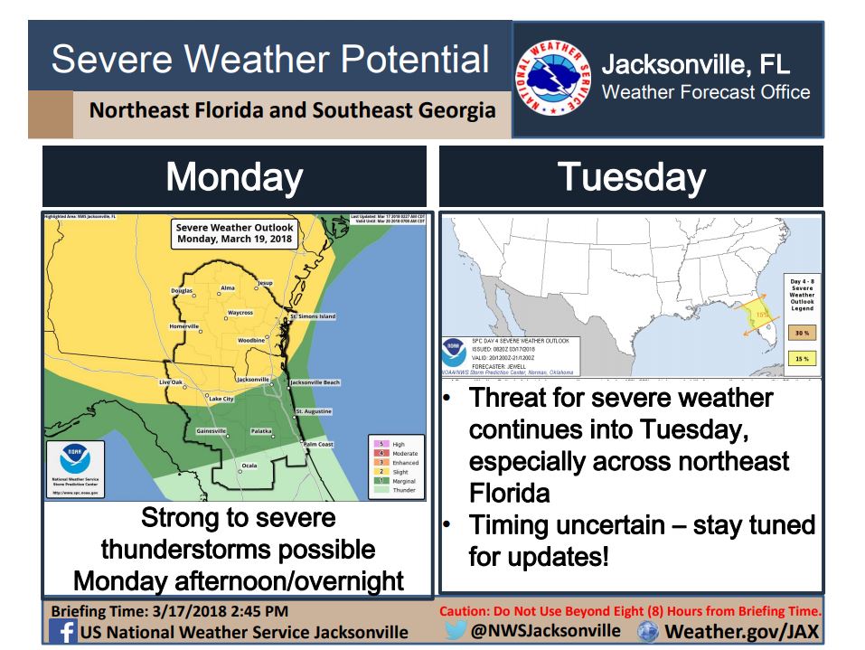
NWS WFO Jacksonville is producing briefings on the increasing severe weather potential for Monday and Tuesday. A strong low pressure is expected to develop over the Southeast on Monday, resulting in a two-day threat for severe weather.
Round 1: On Monday, a warm front across southeast Georgia will pose a threat for strong storms during the afternoon, with severe wind, hail, and tornadoes possible.
Round 2: Overnight Monday, a line of storms from northern Georgia into eastern Alabama will pose of threat for severe winds as it moves into southeast Georgia and northern Florida.
Round 3: As the cold front moves through the area on Tuesday, strong storms could once again develop across north and north-central Florida and will pose a threat for severe wind, hail, and tornadoes.
As this is a fluid situation with many factors involved, check in for further updates throughout the weekend. Here is the latest briefing image:

Please reference our PDF briefing available here:
http://www.weather.gov/media/jax/briefings/nws-jax-briefing.pdf
The briefing will be updated at least once a day. It will be updated more frequently if needed.
Please refer to this briefing page during the event for updated local forecast and weather impact information. We will not send e-mails to announce updates to the briefing.
Thank you for your partnership,
Nate McGinnis
Meteorologist, NWS WFO Jacksonville
Additional Information Resources:
NWS Jacksonville: (904) 741-4370
NWS JAX: http://www.weather.gov/jax/
River Stages: http://water.weather.gov/ahps2/index.php?wfo=jax
NWS JAX Facebook: facebook.com/US.NationalWeatherService.Jacksonville.gov
NWS Jacksonville Twitter: twitter.com/NWSJacksonville
NWS for Mobile Phones: mobile.weather.gov

