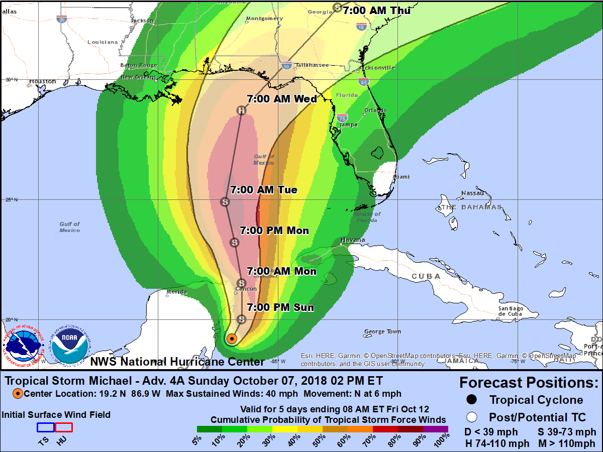
Tropical Depression #14 has strengthened to Tropical Storm Michael
Tropical Depression #14 has strengthened to Tropical Storm Michael. The system is east of the Mexican state of Quintana Roo off of the Mexico’s Yucatan Peninsula. Gradual strengthening and some increase in forward speed is forecast as the tropical cyclone moves northward into the Gulf of Mexico early this week. The official forecast still indicates a potential hurricane landfall along the Florida panhandle or Big Bend coast at hurricane strength midweek. By Wednesday night, the storm is forecast to be over interior Georgia. Tropical force winds may potentially occur from late Wednesday morning through the evening across the Suwanee Valley and across interior Southeast Georgia and immediately along the Georgia coast from late Wednesday afternoon into the pre-dawn hours Thursday morning.
Well in advance of the approach of Tropical Storm Michael onshore winds will strengthen along the Atlantic coast Monday and Tuesday. These onshore winds will combine with an increasingly elevated astronomical tide due to the new moon to create at least minor coastal flooding during times of high tide, which could begin as early as Monday at the Atlantic coastal communities. Waves of showers and thunderstorms will increase in coverage by Tuesday, with local impacts continuing through at least Thursday morning before Tropical Storm Michael accelerates northeastward towards the Carolinas on Thursday.

Local Impacts & Considerations:
- High risk of rip currents through at least midweek.
- Threat for at least minor coastal flooding along the Atlantic beaches increases early this week as easterly winds strengthen well in advance of any direct impacts from TS Michael.
- Waves of heavy rainfall and embedded thunderstorms beginning Tuesday and persisting through Thursday morning, based on the latest official TS Michael forecast from NHC.
- Still too early to specify potential rainfall amounts, timing of tropical storm force winds or threat for severe weather or tornadoes as outer rain bands move through our region late Tuesday through Thursday morning.
- Be cautious of speculation of storm impacts, especially on social media

